Licensing
CivicSight requires one license per organization. For roughly the cost of one leading desktop GIS software, CivicSight can be installed on as many desktops and laptops as needed.
Providing GIS services to local government
River’s Edge GIS is a geographic information consulting company providing services for local, regional, and state governemnt agencies. Services range from data conversion to software development. River's Edge combined staff has been working in the field of GIS for over 30 years, almost exclusively with local governments.
Need your master plan updated or other cartographic products, consider River's Edge for your mapping requirements.
Need GIS services, but not a full time position, consider on-site GIS services from River's Edge. We can tailor or service options to fit your GIS needs.
Whether it be for a few people or your entire enterpirse, cloud services offer GIS solutions on many levels!
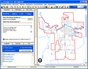
CivicSight has been providing access to GIS Data for 20+ years. CivicSight began as a low-cost solution for municpal organizations to distrubute GIS information throughout the organization. Many of the same benefits CivicSight provided back in 1998 are still important today. CivicSight functionality has increased to meet the needs of current users and also to meet the changing technology requirements.
CivicSight requires one license per organization. For roughly the cost of one leading desktop GIS software, CivicSight can be installed on as many desktops and laptops as needed.
CivicSIght supports ESRI, AUtoCAD, Microstation, and many Image (raster) data sets.
River's Edge is a small company made up of one Principal and one GIS Analyst/Technician. Projects range from stand-alone applications, mapping projects, data conversion projects, and web based applications.

Principal

GIS Technician
2483 Bravender Road, Williamston, MI 48895
Phone: 616.481.1861
E-mail: